The Chardham Yatra — one of India’s most sacred Hindu pilgrimages — takes devotees to the four holy shrines of Yamunotri, Gangotri, Kedarnath, and Badrinath in the higher Himalayas of Uttarakhand. Every year between April and October, millions of pilgrims undertake this spiritual journey. However, mountain weather dynamics, monsoon rains, ecological fragility, infrastructure projects, and road conditions deeply influence whether pilgrims can reach these sacred spots safely and smoothly.
In 2025–26, road conditions along the Chardham routes have drawn significant attention — and concern — due to weather disruptions, landslides, infrastructure pressures, and operational challenges. These factors have shaped both pilgrim experiences and administrative responses this year.
1. Overview: Why Road Conditions Matter for Chardham Yatra
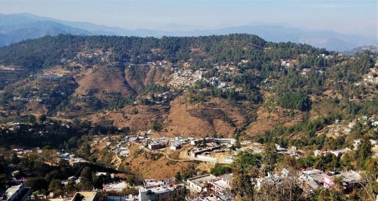
The Char Dham routes traverse steep Himalayan terrain, criss-crossed by rivers, narrow gorges, and fragile slopes. Unlike flat plains, mountain roads are inherently vulnerable to weather events like rain, cloudbursts, and landslides. For pilgrims visiting sacred towns like Gaurikund (gateway to Kedarnath) and Yamunotri/Gangotri highways, road stability directly affects access.
Good road conditions ensure:
- Safety of vehicles and pilgrims
- Continuous access to shrines
- Economic activity for local communities
- Effective emergency response and evacuation
Conversely, poor road conditions can result in roadblocks, suspension of pilgrim traffic, and in extreme cases, injuries or loss of life.
2. Weather and Monsoon Impact on Roads
This year’s road conditions have been heavily influenced by the erratic and intense monsoon cycle in the Himalayas. According to recent observations, high rainfall, saturated soils, and dormant landslide zones were reactivated across key districts like Chamoli, Rudraprayag, and Uttarkashi. Scientists link this to prolonged rain events that weakened slopes and triggered multiple landslides on major highways.
The result:
- Frequent landslides disrupting NH stretches leading to shrines
- Road closures and intermittent traffic suspension
- Increased risk to travellers and maintenance crews
One report highlighted that mountains experienced “old fault lines surging landslides” due to heavy monsoon rain — illustrating the fragility of Himalayan infrastructure in extreme weather.
Additionally, monsoon-related weather alerts from the India Meteorological Department (IMD) brought orange alerts for heavy to very heavy rainfall in several districts. Such alerts often translated into blocked roads and halted travel. In one instance, 155 roads were blocked across Uttarakhand due to landslides triggered by overnight rain.
3. Major Road Disruptions and Temporary Bans
Throughout the Yatra season this year:
a. Suspension and Partial Closures
- Authorities temporarily suspended the Chardham Yatra during intense rains and cloudbursts — especially in late June and early September — to protect pilgrims.
- Travel to Gangotri and Yamunotri remained suspended in early September due to heavily damaged approach roads that were considered unsafe.
b. Landslide Blockages
In July, heavy downpours and flash floods halted movement on the pedestrian path from Gaurikund to Kedarnath, with debris blocking the route and requiring clearance operations.
Such events forced district officials to issue 24-hour local travel bans or equivalent restrictions during high-risk periods, with enforcement dependent on real-time weather conditions at different altitude zones.
4. Road Access to Key Dhams — Current Status
While overall conditions have improved at times, individual routes vary significantly:
a. Yamunotri and Gangotri
These routes suffered significant damage from heavy rainfall events this year. As of early September, they remained closed or restricted pending road restoration and safety assessments — primarily due to landslides and slope instability.
b. Kedarnath
The national highway (NH-107) to Kedarnath — one of the steepest and most challenging approaches — was reported to be open with conditional timings (e.g., allowing travel only during safer daylight hours) as authorities balanced accessibility with risk.
Nonetheless, local road quality varies, and pilgrims still faced delays caused by narrow stretches, debris, and temporary blockages.
c. Badrinath
Roads to Badrinath, especially the Badrinath Highway, also dealt with landslide-related closures at spots like Kamera and Pagal Nala, although these were periodically cleared by BRO and state agencies.
5. Government and Administrative Measures
In response to these challenges, the government and local authorities introduced several initiatives this year:
a. Real-Time Weather Controls
District magistrates were empowered to stop or resume vehicle movement in their respective sectors based on local forecasts and ground conditions.
b. Road Maintenance and Clearing Operations
The Border Roads Organisation (BRO) and National Highway personnel engaged in continual clearing of debris and reinforcement of vulnerable stretches to keep highways passable where possible.
c. Registration and Traffic Management
To manage road traffic and avoid congestion — which itself can increase risks in unstable conditions — the state made pilgrim and vehicle registration mandatory. All private vehicles entering Uttarakhand for Chardham had to be registered, with non-registered vehicles parked at Rishikesh and pilgrims transferred to local vehicles.
This measure was aimed at controlling traffic density during peak flow periods and potentially reducing stress on roads.
6. Environmental and Infrastructure Concerns
While improving access is a priority, this year saw strong environmental concerns raised about the broader Char Dham infrastructure drive:
a. Ecological Damage Warning
Experts warned that unscientific hill cutting and muck dumping as part of road widening projects could be exacerbating landslide risks and environmental degradation in the fragile Himalayas.
b. Road Widening in Ecologically Sensitive Zones
Controversial approvals for road widening in the Bhagirathi Eco Sensitive Zone were criticized by environmentalists worried about tree felling and erosion, further complicating the region’s natural resilience.
These debates highlight the tension between development for pilgrim access and environmental sustainability, which directly affects road conditions and safety.
7. Pilgrim Experiences and Travel Challenges
Pilgrims travelling during peak and monsoon-affected periods reported real-world challenges:
- Unpredictable weather caused delays and forced pilgrims to adjust itineraries on the fly.
- Landslide-related blockages and route closures sometimes led to waiting periods on narrow mountain roads.
- Traffic jams and narrow, unstable stretches remained a persistent issue, especially on approaches to Gangotri and Yamunotri.
Many travellers emphasized the importance of flexibility, early starts, and contingency planning when navigating these routes.
Such grassroots accounts underline that even when official road corridors are “open,” conditions can be slow, narrow, and subject to weather disruptions.
8. Safety and Emergency Preparedness
Given the ongoing uncertainties in road conditions this year, safety protocols were emphasized:
- Authorities strongly advised pilgrims to check real-time weather and road updates before departing.
- Travel was recommended during safe daylight hours rather than in rain or darkness.
- Medical and relief posts along routes were expanded to support emergencies.
- Helicopter services continued with updated safety protocols, offering an alternate in emergencies or when roads were compromised.
Despite helicopter crashes reported on these routes earlier in the year — highlighting the dangers of mountain flying in unstable weather — stringent safety measures were implemented.
9. Practical Advice for Pilgrims This Year
For those planning to undertake the Chardham Yatra this season (2025–26), here are key road and travel considerations:
a. Prioritize Weather Monitoring
Always check local weather forecasts and IMD alerts before travelling, and be prepared to delay if heavy rain or storms are predicted.
b. Allow Travel Flexibility
Road closures can occur suddenly. Build buffer days into your itinerary to accommodate possible delays.
c. Start Early Each Day
Mountain roads experience fewer weather-induced hazards during morning hours; afternoon rain or fog can worsen slopes and visibility.
d. Use Official Updates
Follow government and district announcements on road reopenings, traffic advisories, and pilgrim guidance.
e. Stay Prepared for Road Slowdowns
Even where highways are open, narrow stretches, slow landslide clearance, and traffic management can slow progress.
10. Looking Ahead: Infrastructure and Resilience
Going forward, improving resilience-based infrastructure — including better drainage, slope stabilization, early warning systems, and ecologically sensitive road engineering — will be crucial. Experts urge that instead of focusing solely on record pilgrim numbers, authorities must prioritize climate-adapted infrastructure and sustainable road networks to protect both pilgrims and local ecosystems.
Conclusion
In 2025–26, Chardham Yatra road conditions have been a mix of stability and disruption, shaped by erratic monsoon patterns, landslides, administrative controls, and infrastructure challenges. While authorities have worked to keep major highways open and safe, pilgrims faced intermittent closures, precautionary suspensions, and unpredictable travel days due to weather and slope vulnerabilities. These challenges emphasize the importance of careful planning, real-time updates, and road safety awareness for anyone undertaking the sacred journey this year.